
Inspiration & Stories
Fall Hikes You Never Heard Of
You can’t beat fall in Truckee-Tahoe. The crisp mountain air and warm afternoon sun are perfect for hiking, riding, running, or climbing with gorgeous colors as a backdrop. Aspen and cottonwood trees put on a spectacular display of yellow, orange and gold - a delight for leaf peepers, photographers, and outdoor adventurers alike. Ready to get in on the fall action? Check out these lesser-known trails and remember to always Recreate Responsibly and take care of Truckee-Tahoe's beautiful public lands.
Before you go!
- Read the Truckee-Tahoe Travel Alert for updates on trails, air quality, weather and more.
- Take the Truckee-Tahoe Traveler Responsibility Pledge to learn how to be safe, responsible and mindful of our community during your travels.
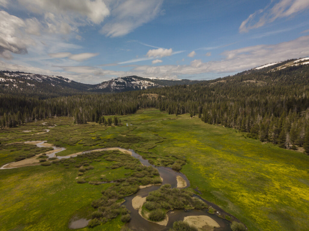
Lacey Meadow
A short drive north of Truckee, Lacey Meadow near Webber Lake offers a stunning hike at the headwaters of the Little Truckee River. The out and back trail is wide and mostly flat which makes it a good choice for families with children. Budding naturalists should remember to bring their binoculars; this is an amazing trail for birdwatching!
- Type - Out and back
- Distance - 6.6 miles
- Elevation Gain - 252 feet
- Alltrails Map
Perazzo Meadows
Looking for a gorgeous picnic spot? Perazzo Meadows is it. Two picnic areas on bluffs above the river invite you to sit and stay a while, so pack a picnic lunch! Please remember to Leave No Trace as this site sustains a number of rare species and plays a vital role in the Truckee River Watershed.
- Type - Out and back
- Distance - 2.4 miles
- Elevation Gain - 200 feet
- Alltrails Map
Elizabethtown Meadows
Tucked away across from the entrance to Northstar California Resort, off of Highway 267, Elizabethtown Meadows offers a peaceful stroll past three large mountain meadows, a yearround stream, and forests of Jeffrey pine and aspen. Once the site of a booming silver rush town in the 1870s, today it’s a retreat for hikers seeking quiet, serene trails. This SF Gate article even calls Elizabethtown Meadows, “a walking meditation of Jeffrey pine, manzanita and sagebrush.”
- Type - Out and back
- Distance - 5 miles
- Elevation Gain - 475 feet
- Alltrails Map
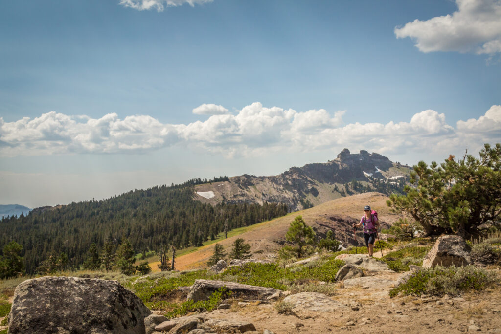
Warren Lake
You’re probably familiar with Truckee’s iconic Castle Peak, the towering mountain that greets you as you drive in from Highway 80 West, but what lies just beyond it? While most opt for the popular hiking trail to Castle Peak’s summit, the backside holds spectacular terrain including the Frog Lake Cliffs above Frog Lake and Warren Lake further north.
- Type - Out and back or loop
- Distance - 13.9 miles
- Elevation Gain - 3927 feet
- Alltrails Map
Commemorative Overland Emigrant Trail
Follow a historical wagon route traveled by early settlers in 1844! While the Commemorative Overland Emigrant Trail is more than 15 miles long (one way), starting across from Carpenter Valley Road and hiking out and back to Alder Creek makes for an excellent day hike. This quiet section meanders alongside a creek through open meadows and stands of aspen and pine, a great choice for a relaxing stroll or beginner mountain bike ride.
- Type - Out and back
- Distance - 5.2 miles
- Elevation Gain - 403 feet
- Alltrails Map
Donner Summit Canyon
Donner Summit Canyon follows the route of the historical Dutch Flat/Donner Lake Wagon Road which eventually became the old Lincoln Highway, the predecessor to Donner Pass Road. As you hike towards the summit, imagine driving an early automobile up the steep road grade, 18% in places! At the top of the canyon, you can access a Native American Petroglyph site, the China Wall, as well as the world’s first automobile underpass. The highlight of this hike is a scenic picnic spot about a mile up the trail where you are treated to a birds-eye view of Donner Lake.
- Type - Lollipop loop
- Distance - 3.9 miles
- Elevation Gain - 531 feet
- Alltrails Map
Point Mariah
Stand at Point Mariah and gaze into one of the deepest canyons in the Western US! This hike near Serene Lakes takes you to an incredible overlook with views of Royal Gorge, Sugar Bowl, the Pacific Crest Trail, Devils Peak and beyond. You can see the Headwaters of the American River and much of the Granite Peak Wilderness which backs up to Palisades Tahoe. Make it a sunrise hike for a special treat!
- Type - Out and Back
- Distance - 5 miles
- Elevation Gain - 583 feet
- Alltrails Map
Mount Lola
Hey peak baggers, have you crossed off the highest peak in the Tahoe National Forest? At 9143 feet, Mount Lola is the highest Sierra Nevada peak north of Highway i80. The trail takes you through forests, meadows, along Cold Stream to the summit, where you get breathtaking views of Independence Lake and White Rock Lake below.
- Type - Out and back
- Distance - 10.9 miles
- Elevation Gain - 2532 feet
- Alltrails Map
Happy trails! Please remember to Recreate Responsibly.*All distances and elevations are approximate